Includes
- 🏡Accommodation each night
- 🍳Complimentary breakfast
- 🎒Luggage transfer service (20kg bag per person)
- 📱App with your map
- 📞Local office in Newcastle
Prices
- 👥Double - £445 per person
- 🛏️Twin - £445 per person
- 🧍Single - Contact for price
Book this tour
Want more info?
Trip Itinerary
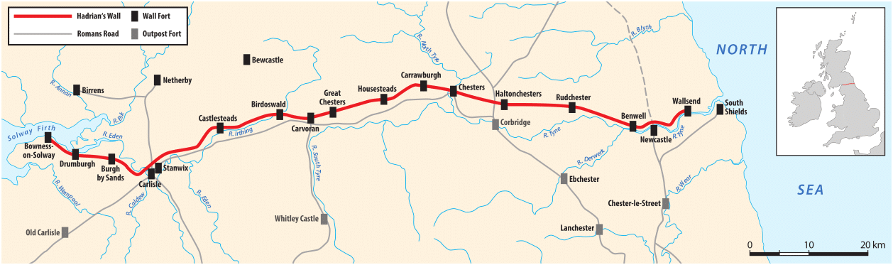
Your walk begins at Segedunum Roman Fort in Wallsend, the most easterly point of the Wall. You follow the line of the Wall west through Newcastle's eastern suburbs, crossing the Tyne via the Millennium Bridge (or the Swing Bridge), and passing through the city centre before climbing to Heddon-on-the-Wall — home to the longest visible stretch of Wall in the east. Your first night's accommodation is in or near Heddon-on-the-Wall or Corbridge.
From Heddon the route crosses open farmland and enters the Tyne Valley, passing through the market town of Corbridge with its Roman remains. The path climbs steadily as you head towards Chesters Roman Fort, one of the best-preserved cavalry forts on the Wall, set beside the North Tyne river at Chollerford. Your second night is in the Chollerford / Hexham area.
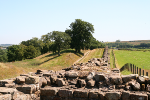
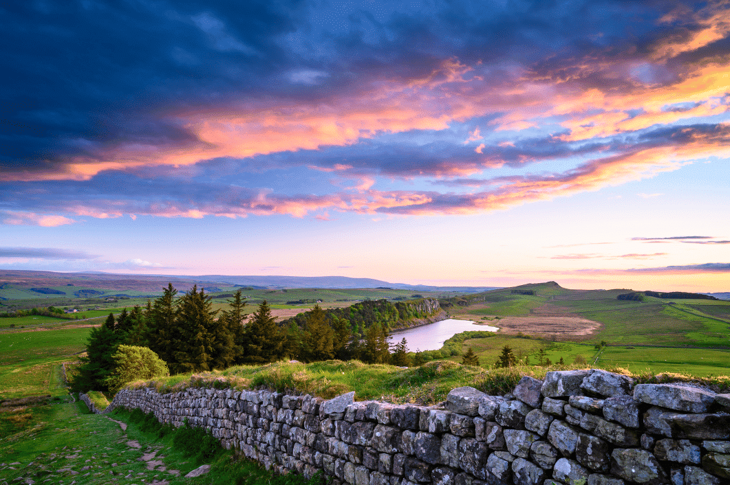
This is where the walk transforms. Leaving the Tyne Valley behind, the path climbs dramatically onto the Whin Sill — the great volcanic ridge that carries the Wall across the highest ground in Northumberland. You'll pass Housesteads (Vercovicium), the most atmospheric and complete fort on the entire Wall, then continue west along the switchback crags to Steel Rigg near Once Brewed. This is the toughest day of the walk and also the most spectacular. Your third night is near Steel Rigg or Once Brewed.
The Whin Sill continues to deliver dramatic scenery as you walk west from Steel Rigg, passing the Nine Nicks of Thirlwall and the remarkable Milecastle 42 at Cawfields. The Wall becomes more fragmentary west of here but the views remain superb. You descend to the village of Gilsland where the Wall crosses the River Irthing, with Birdoswald Roman Fort — the largest surviving stretch of original Wall — just a short detour away. Your fourth night is in the Gilsland / Brampton area.
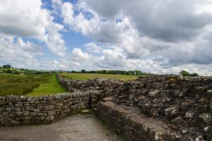
The character of the walk changes again as you leave Northumberland and enter Cumbria. The high crags give way to rolling pastoral countryside, with the Wall running through fields and farmland. You pass through Carlisle — a great opportunity for lunch and a visit to the castle and cathedral — before continuing to the village of Burgh-by-Sands on the edge of the Solway marshes.
The final day follows the line of the Vallum and Wall across the Solway Plain, with views south across the Solway Firth to the Scottish hills on a clear day. The path can be tidal along some stretches so timing matters. You finish at the small village of Bowness-on-Solway, where a modest stone marks the western terminus of the trail. A well-earned pint at the Kings Arms is traditional.
## What's included
- Five nights' accommodation in selected B&Bs and guesthouses - Luggage transfer each walking day - Comprehensive pre-departure information pack - Step-by-step route notes for each day - 1:25,000 OS maps for each section - GPX files for phone or GPS device - 24/7 on-trip support phone number - Welcome information and practical tips
## Practical notes
**Start point:** Segedunum Roman Fort, Wallsend, NE28 6HR. The nearest train station is Wallsend Metro (on the Tyne and Wear Metro, change at Central Station). By car, there is parking at or near Segedunum.
**End point:** Bowness-on-Solway, CA7 5AX. A seasonal bus service connects Bowness to Carlisle (approximately 30 minutes), from where there are frequent trains to Newcastle, Edinburgh, and London. Taxis from Bowness to Carlisle take around 30 minutes.
**Physical grade:** Moderate to strenuous. Day 3 involves significant ascent and descent. All days involve some uneven ground. You should be comfortable walking for five to six hours per day.
**Best months:** May to September.